File:Regions and Prefectures of Japan (ja).png

Mannària de custa anteprima: 441 × 600 pixels. Àteras risolutziones: 176 × 240 pixels | 353 × 480 pixels | 565 × 768 pixels | 753 × 1,024 pixels | 2,480 × 3,372 pixels
Versione a risolutzione arta (2,480 × 3,372 pixels, mannesa de su file: 456 KB, tipu de MIME: image/png)
Ogetu
| Descritzione |
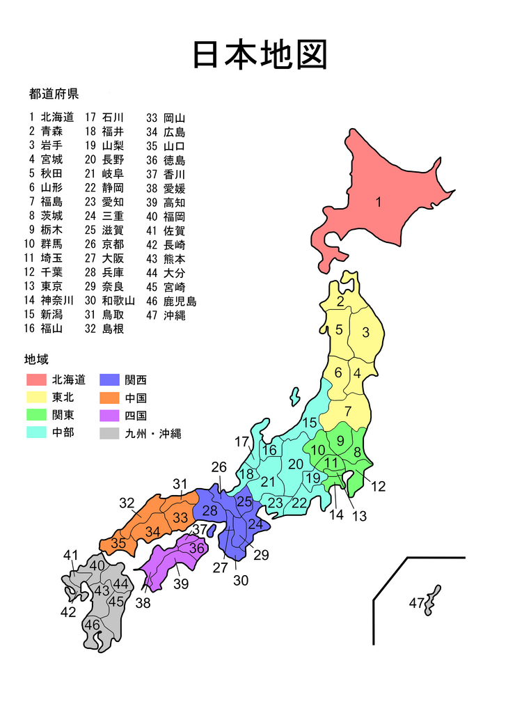
English: Map of Japan with prefectures named and colour-coded by region |
|||
| Data | ||||
| Mitza |
Traballu pròpriu |
|||
| Autore | Montydrei | |||
| Àteras versiones |
|

.svg)


.svg)
.svg)
.svg)
.svg)


.svg)


.png)

.png)

.svg)


.png)
Litzèntzia
| I, the copyright holder of this work, release this work into the public domain. This applies worldwide. In some countries this may not be legally possible; if so: I grant anyone the right to use this work for any purpose, without any conditions, unless such conditions are required by law. |
Istòria de su file
Carca unu grupu data/ora pro castiare su file comente si presentada in su tempus indicadu.
| Data/Ora | Miniatura | Dimensiones | Utente | Cumentu | |
|---|---|---|---|---|---|
| atuale | 08:09, 3 Stg 2006 | | 2,480 × 3,372 (456 KB) | Montydrei | Created by myself using Inkscape. |
Ligant a custu file
Peruna pàgina ligat a custu file.
Impreu globale de su documentu
Impreu de custu documentu in àteras wikis:
- Impreu in sah.wikipedia.org
- Impreu in simple.wikipedia.org
- Impreu in stq.wikipedia.org
- Impreu in sw.wikipedia.org
- Impreu in zh-yue.wikipedia.org
.png)