File:SD in SD County map.png

Mannària de custa anteprima: 777 × 600 pixels. Àteras risolutziones: 311 × 240 pixels | 622 × 480 pixels | 995 × 768 pixels | 1,026 × 792 pixels
Versione a risolutzione arta (1,026 × 792 pixels, mannesa de su file: 27 KB, tipu de MIME: image/png)
Ogetu
| Descritzione |
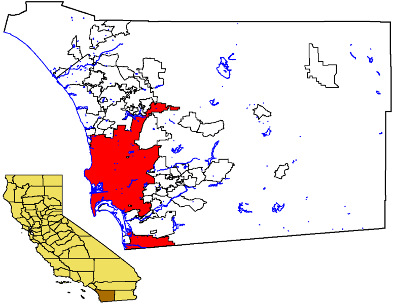
English: Locator map of the City of San Diego — in southwestern San Diego County, Southern California.
|
| Data | 17 Santandria 2005 (original upload date) |
| Mitza | No machine-readable source provided. Own work assumed (based on copyright claims). |
| Autore | No machine-readable author provided. Otto Normalverbraucher assumed (based on copyright claims). |
Litzèntzia
| I, the copyright holder of this work, release this work into the public domain. This applies worldwide. In some countries this may not be legally possible; if so: I grant anyone the right to use this work for any purpose, without any conditions, unless such conditions are required by law. |
Istòria de su file
Carca unu grupu data/ora pro castiare su file comente si presentada in su tempus indicadu.
| Data/Ora | Miniatura | Dimensiones | Utente | Cumentu | |
|---|---|---|---|---|---|
| atuale | 23:11, 17 Std 2005 | | 1,026 × 792 (27 KB) | Otto Normalverbraucher | from the english wikipedia. original description: "Map of the City of San Diego within San Diego County, with County highlighted in California. I created this map from US Census Bureau data. I release it to Public Domain" by first publisher [[:en:User:Ma |
| 23:02, 17 Std 2005 |  | 1,026 × 792 (27 KB) | Otto Normalverbraucher | from the english wikipedia. original description: "Map of the City of San Diego within San Diego County, with County highlighted in California. I created this map from US Census Bureau data. I release it to Public Domain" by first publisher [[en:User:Mac |
Ligant a custu file
Sa pàgina chi sighit impreat custu documentu:
Impreu globale de su documentu
Impreu de custu documentu in àteras wikis:
- Impreu in ar.wikipedia.org
- Impreu in es.wikipedia.org
- Impreu in he.wikipedia.org
- Impreu in lmo.wikipedia.org
- Impreu in pam.wikipedia.org
- Impreu in sk.wikipedia.org
- Impreu in vi.wikipedia.org