File:CHL orthographic.svg

Size of this PNG preview of this SVG file: 551 × 551 pixels. Àteras risolutziones: 240 × 240 pixels | 480 × 480 pixels | 768 × 768 pixels | 1,024 × 1,024 pixels | 2,048 × 2,048 pixels
Versione a risolutzione arta (file in formadu SVG, mannesa nominale 551 × 551 pixel, mannesa de su file: 1,012 KB)
Ogetu
| Descritzione |
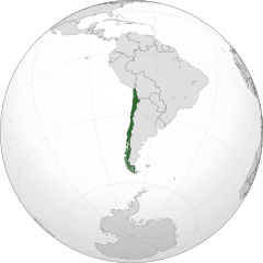
Čeština: Ortografická mapa Chile zaměřená na 37° severní šířky, 71° západní délky.
Oficiální území.
Nárokovaná území. English: A map of the hemisphere centred on -71, -37, using an orthographic projection, created using gringer's Perl script with Natural Earth Data (1:50000 resolution, simplified to 0.25px).
Chile is highlighted in green. Official territory.
Claimed territories. |
| Data | |
| Mitza | Traballu pròpriu with Natural Earth Data |
| Autore | Addicted04 |
| SVG genesis |
.svg)
.svg)
.svg)
.svg)
.svg)
.svg)
.svg)
.svg)
.svg)
.svg)
.svg)
.svg)
.svg)
.svg)
.svg)
.svg)
.svg)
.svg)
.svg)
.svg)
.svg)
.svg)
.svg)
.svg)
.svg)
.svg)
.svg)
.svg)
.svg)
.svg)
.svg)
.svg)
.svg)
.svg)
.svg)
.svg)
.svg)
.svg)
.svg)
.svg)
.svg)
.svg)
.svg)
.svg)
.svg)
.svg)
.svg)
.svg)
.svg)
.svg)
.svg)
.svg)
.svg)
.svg)
.svg)
.svg)
.svg)
.svg)
.svg)
.svg)
.svg)
.svg)
.svg)
.svg)
.svg)
.svg)
.svg)
.svg)
.svg)
.svg)
.svg)
.svg)
.svg)
.svg)

.svg)

.svg)

.svg)
.svg)
.svg)
.svg)
.svg)
.svg)
.svg)


.svg)
.svg)
.svg)
.svg)
.svg)
.svg)
.svg)

.svg)
.svg)
.svg)
.svg)
.svg)
.svg)
.svg)
.svg)
.svg)

.svg)
.svg)
.svg)
.svg)
.svg)
.svg)
.svg)
_without_national_boundaries.svg)
.svg)
.svg)
.svg)
.svg)
.svg)
.svg)

.svg)
.svg)
.png)
.svg)
.svg)
.svg)
.svg)

.svg)
.svg)
.svg)
.svg)
.svg)
.svg)
.svg)
.svg)
.svg)
.svg)
.svg)

.svg)
.svg)
.svg)
.svg)
.svg)
.svg)
.svg)
.svg)
.svg)

.svg)
.svg)

.svg)
.svg)
.svg)
.svg)
.svg)
.svg)
.svg)
.svg)
.svg)
.svg)
.svg)
.svg)
.svg)
.svg)
.svg)
.svg)
.svg)
.svg)
.svg)
.svg)
.svg)
.svg)
.svg)
.svg)
.svg)
.svg)
.svg)
_-_Crimea_disputed.svg)
.svg)
.svg)
.svg)
.svg)
.svg)
.svg)
.svg)
.svg)
.svg)
.svg)
.svg)
_political.svg)
.svg)
.svg)
.svg)
.svg)
_-_Crimea_disputed_-_no_borders.svg)
.svg)
.svg)
.svg)
.svg)
.svg)
.svg)
.svg)
.svg)
.svg)
.svg)
.svg)

.svg)
.svg)
.svg)

.png)
.svg)
.svg)
.svg)
.svg)
.svg)
.svg)
.svg)
.svg)
.svg)
.svg)
.svg)
.svg)
.svg)
.svg)
.svg)
.svg)
.svg)
.svg)
.svg)
.svg)
.svg)
.svg)
.svg)
.svg)
.svg)
.svg)
.svg)
.svg)
.svg)
.svg)
.svg)
.svg)
.svg)
.svg)
.png)
.svg)
.svg)
.svg)
_(orthographic_projection).png)
| Orthographic projections maps created by Ssolbergj |
|---|
| Orthographic projections maps created by Ssolbergj: |
.svg)
.svg)
Litzèntzia
| I, the copyright holder of this work, release this work into the public domain. This applies worldwide. In some countries this may not be legally possible; if so: I grant anyone the right to use this work for any purpose, without any conditions, unless such conditions are required by law. |
Istòria de su file
Carca unu grupu data/ora pro castiare su file comente si presentada in su tempus indicadu.
| Data/Ora | Miniatura | Dimensiones | Utente | Cumentu | |
|---|---|---|---|---|---|
| atuale | 01:14, 20 Ghe 2014 | | 551 × 551 (1,012 KB) | Addicted04 | New map, Chile ''de facto'' only, for claims see File:CHL orthographic (+all claims).svg |
| 22:21, 12 Cab 2012 |  | 550 × 550 (496 KB) | Palosirkka | Scrubbed with http://codedread.com/scour/ | |
| 00:56, 23 Stg 2011 |  | 550 × 550 (707 KB) | Addicted04 | claimed color | |
| 00:08, 23 Stg 2011 |  | 550 × 550 (707 KB) | Addicted04 | claimed color | |
| 22:31, 14 Stg 2011 |  | 550 × 550 (707 KB) | Addicted04 | New map | |
| 03:12, 6 Std 2010 |  | 550 × 550 (642 KB) | Addicted04 | {{Information |Description={{en|1=Orthographic map of Chile}} {{es|1=Mapa ortográfico de Chile}} |Source={{own}} |Author=Addicted04 |Date=2010- |
.svg)
Ligant a custu file
Sa pàgina chi sighit impreat custu documentu:
Impreu globale de su documentu
Impreu de custu documentu in àteras wikis:
- Impreu in af.wikipedia.org
- Impreu in arc.wikipedia.org
- Impreu in ar.wikipedia.org
- الحكم العسكري في تشيلي (1973-90)
- مستخدم:جار الله/قائمة صور مقالات العلاقات الثنائية
- العلاقات الأمريكية التشيلية
- العلاقات الأنغولية التشيلية
- العلاقات التشيلية الكورية الجنوبية
- العلاقات الإريترية التشيلية
- العلاقات التشيلية السويسرية
- العلاقات الألمانية التشيلية
- العلاقات التشيلية الليختنشتانية
- العلاقات البوليفية التشيلية
- العلاقات التشيلية الموزمبيقية
- العلاقات الألبانية التشيلية
- العلاقات البلجيكية التشيلية
- العلاقات الإثيوبية التشيلية
- العلاقات التشيلية البيلاروسية
- العلاقات التشيلية الطاجيكستانية
- العلاقات التشيلية الروسية
- العلاقات التشيلية الرومانية
- العلاقات التشيلية الغامبية
- العلاقات التشيلية القبرصية
- العلاقات التشيلية السيراليونية
- العلاقات التشيلية النيبالية
- العلاقات التشيلية الليبيرية
- العلاقات التشيكية التشيلية
- العلاقات التشيلية الميانمارية
- العلاقات السعودية التشيلية
- العلاقات التشيلية الكندية
- العلاقات التشيلية الزيمبابوية
- العلاقات الإسرائيلية التشيلية
- العلاقات البالاوية التشيلية
- العلاقات التشيلية المالية
- العلاقات التشيلية النيجيرية
- العلاقات اليمنية التشيلية
- العلاقات التشيلية الفانواتية
- العلاقات الغابونية التشيلية
- العلاقات البنمية التشيلية
- العلاقات التشيلية الكوبية
- العلاقات التشيلية الجورجية
- العلاقات التشيلية التونسية
- العلاقات التشيلية الكورية الشمالية
- العلاقات الهندية التشيلية
- العلاقات اليابانية التشيلية
- العلاقات الإيطالية التشيلية
- العلاقات التشيلية الناوروية
- العلاقات الأسترالية التشيلية
- العلاقات التشيلية الزامبية
- العلاقات التشيلية الفيجية
- العلاقات التشيلية المارشالية
Càstia àteros impreos globales de custu documentu.