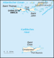
File:Karte Amerikanische Jungferninseln.png

Karte_Amerikanische_Jungferninseln.png(324 × 349 pixels, mannesa de su file: 6 KB, tipu de MIME: image/png)

Custu documentu benit dae Wikimedia Commons e podet èssere impreadu in àteros progetos. A sighire est ammustrada sa descritzione in sa sua pàgina de descritzione de su documentu.

Ogetu

Descritzione
Deutsch: Karte Amerikanische Jungferninseln
Data
Mitza CIA World Factbook
Autore CIA

Litzèntzia

Public domain This image is a work of a Central Intelligence Agency employee, taken or made as part of that person's official duties. As a Work of the United States Government, this image or media is in the public domain in the United States.

čeština  Deutsch  eesti  English  español  français  italiano  português  polski  sicilianu  slovenščina  suomi  Tiếng Việt  български  македонски  русский  українська  বাংলা  മലയാളം  한국어  日本語  中文  中文(简体)  中文(繁體)  العربية  پښتو  +/−

Original upload log

Transferred from de.wikipedia to Commons by Nachcommonsverschieber using CommonsHelper.

The original description page was here. All following user names refer to de.wikipedia.
  • 2004-02-19 16:34 Raymond 328×353× (7380 bytes) Karte Amerikanische Jungferninseln

Captions

Add a one-line explanation of what this file represents
Location map of the American Virgin Islands

Items portrayed in this file

depicts inglesu

Istòria de su file

Carca unu grupu data/ora pro castiare su file comente si presentada in su tempus indicadu.

Data/OraMiniaturaDimensionesUtenteCumentu
atuale16:20, 25 Nad 2017Miniatura de sa versione de is 16:20, 25 Nad 2017324 × 349 (6 KB)Ras67frame removed
21:43, 26 Nad 2012Miniatura de sa versione de is 21:43, 26 Nad 2012328 × 353 (7 KB)File Upload Bot (Magnus Manske)Transfered from de.wikipedia by User:Nachcommonsverschieber using CommonsHelper

Sa pàgina chi sighit impreat custu documentu:

Impreu globale de su documentu

Impreu de custu documentu in àteras wikis:

Metadatos