File:Dover UK locator map.svg

Size of this PNG preview of this SVG file: 800 × 561 pixels. Àteras risolutziones: 320 × 225 pixels | 640 × 449 pixels | 1,024 × 719 pixels | 1,280 × 898 pixels | 2,560 × 1,796 pixels | 1,425 × 1,000 pixels
Versione a risolutzione arta (file in formadu SVG, mannesa nominale 1,425 × 1,000 pixel, mannesa de su file: 1.18 MB)
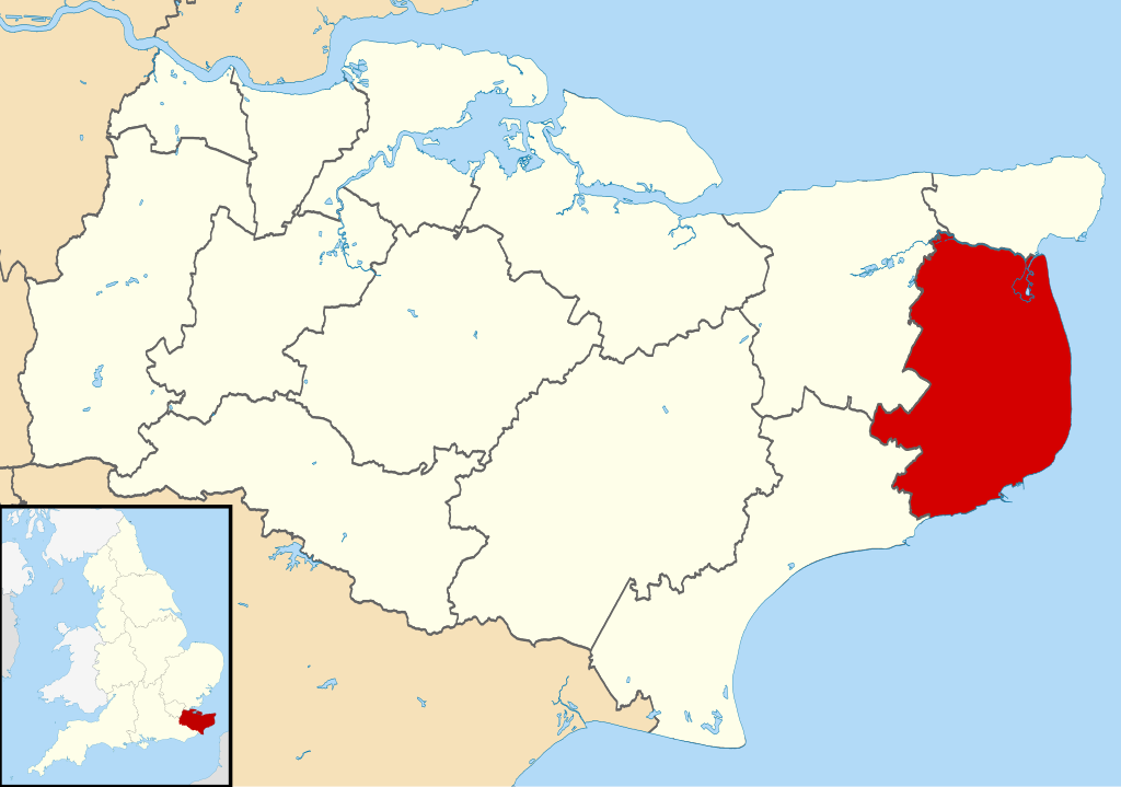
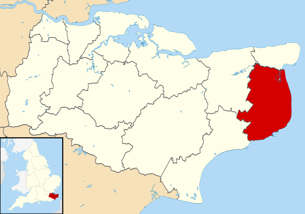
| Descritzione | Equirectangular map projection on WGS 84 datum, with N/S stretched 160% |
| Data | |
| Mitza |
|
| Autore | Nilfanion, created using Ordnance Survey data |
| Licèntzia (Comente torrare a impreare custu documentu) |
Custu documentu est litzentziadu in base a is tèrmines de sa litzèntzia Creative Commons Atributzione-Cumpartzi a sa pròpria manera 3.0 Unported. Atributzione: Contains Ordnance Survey data © Crown copyright and database right
|
Istòria de su file
Carca unu grupu data/ora pro castiare su file comente si presentada in su tempus indicadu.
| Data/Ora | Miniatura | Dimensiones | Utente | Cumentu | |
|---|---|---|---|---|---|
| atuale | 11:07, 2 Aus 2011 | | 1,425 × 1,000 (1.18 MB) | Nilfanion | {{Information |Description=Map of Kent, UK with Dover highlighted. Equirectangular map projection on WGS 84 datum, with N/S stretched 160% |Source=Ordnance Survey [https://www.ordnancesurvey.co.uk/o |
Ligant a custu file
Sa pàgina chi sighit impreat custu documentu:
Impreu globale de su documentu
Impreu de custu documentu in àteras wikis:
- Impreu in cy.wikipedia.org
- Impreu in en.wikipedia.org
- Dover
- Sandwich, Kent
- Walmer
- Eythorne
- Dover District
- East Langdon
- Deal, Kent
- Eastry
- Drellingore
- Kingsdown, Dover
- Maxton, Kent
- Martin, Kent
- Martin Mill
- Coombe, Kent
- Ash, Dover District
- West Langdon
- Wingham, Kent
- Barfrestone
- Kearsney, Kent
- Elvington, Kent
- Capel-le-Ferne
- Richborough
- Lydden
- Whitfield, Kent
- Alkham
- Ripple, Kent
- Aylesham
- Nonington
- Marley, Dover
- Temple Ewell
- Preston-next-Wingham
- River, Kent
- Shepherdswell
- Plucks Gutter
- Template:Towns and villages in Dover district
- St Margaret's at Cliffe
- Sholden
- Tilmanstone
- Buckland, Kent
- Staple, Kent
- Great Mongeham
- User:O1ive/Dover
- Goodnestone, Dover
- Woodnesborough
- Guston, Kent
- Stourmouth
- Ashley, Kent
- Coldred
- Denton, Kent
Càstia àteros impreos globales de custu documentu.